Nantahala Outdoor Center to Clingmans Dome (137.1 Mile to 198.9 Mile)
Prologue
This is the year we have been waiting for – the year Julie and I catch up to Chris and Blake and the four of us continue our AT adventure together. But in order for this to happen, Julie and I must first hike 13.6 miles to meet up with the guys at Stechoah Gap. And in order to get these extra miles in, Julie and I have to hike a day and half before Chris and Blake hit the trail.
So our story begins on a Friday morning, May 27, 2016. The original plan is to meet Chris and Blake at their house in Slidell around 1300 or 1400, load up all our gear, and then make the eight hour drive to Memaw and Pop’s in Lawrenceville, Georgia. But Chris informs up late that morning that he is unable to get away from work as early as he thought and it will probably be closer to 1600 before he gets to his house. Julie and I still leave our house in Houma around noon to head to Slidell and we are in no big hurry since receiving the news from Chris. So when we get to Slidell, we have lunch and a beer at one of favorite Marine Corps stops – Southside Café. Afterwards, we head to Dick’s Sporting Goods to pick up a couple of last minute camping items. We make it to Chris’ house around 1530 and Blake is there waiting, but still no word from Chris.
Chris eventually shows up around 1600 (he only missed it by 2 hours!) and we quickly load all their gear into our Tahoe and begin our long drive to Georgia – our ETA is somewhere between 0200 and 0300. Julie and I have to begin our hike Saturday morning to close that 13.5 mile gap, so we are a little concerned about lack of sleep. But we make excellent time making as few stops as possible and taking in a quick dinner at Hardee’s (Alas, no home-cooked meal by Memaw this Friday night!). We arrive around 0215 with everyone inside sound asleep. Chris’ daughter, Brianna, and her fiancé, Tre, are there visiting and are asleep on the floor in the living room. We all agree to set our alarms for 0600 with a goal to hit the road around 0630 to make the approximately three-hour drive north to our starting point at the Nantahala Outdoor Center (NOC).
Saturday morning, May 28th, the alarm goes off at 0600. Less than four hours of sleep, I groggily slide out of bed to shower and try to wake up. After a quick shower, I dress in my hiking clothes (thinking to myself that I will be wearing these same clothes for the next three days). I leave the bathroom to Julie and head out to fill our water containers and to make sure all our gear is stowed in the Tahoe. We have only packed what we need for the day and overnight since the plan is to meet Chris and Blake at Stechoah Gap the next morning. So we leave most of our food and change of clothes in a separate bag that Chris and Blake will bring the following morning. We will then repack at Stechoah Gap – but at least our packs will be as light as possible for the long climb out of the NOC.
By the time we get everyone’s gear squared away in the back of the Tahoe, it is 0640. Leaving everyone else asleep inside, the four of us begin our three hour drive north to the NOC. We fear that we will not be able to continue our annual tradition of eating at a Waffle House for breakfast as we draw nearer to the NOC. But within 30 minutes of our destination, we spot a Waffle House and pull in. At least for 2016, the tradition continues!
We arrive at the NOC around 1000. Chris pulls our Tahoe as close as possible to the stairs leading to the trail out of the NOC. Julie and I begin our 4th hiking adventure at about 1020 with 10.5 miles to go to our tent site at Locust Cove Gap. Chris and Blake plan on staying the day (and night) at the NOC and then travel to the end point (Newfound Gap parking lot) Sunday morning and leave the Tahoe there. Chris had arranged for a shuttle to take them from Newfound Gap to Stechoah Gap, but Brianna and Tre offer to bring them, so Chris cancels the shuttle driver.


Day 1: Nantahala Outdoor Center to Locust Cove Gap (10.5 trail miles)
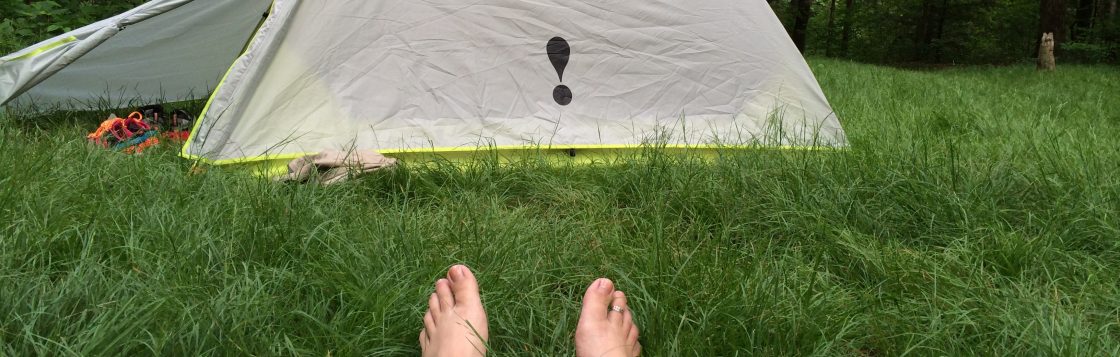
There has been a lot of anxiety building up as the moment draws closer and closer – the moment we take those first steps upward knowing the climb does not relent until just over six miles of hiking. But our legs are fresh and our packs are as light as possible. Julie does her usual thing: hike for a few minutes and then stop and rest and catch her breathe. But this year she is in better physical condition and we average well under a mile an hour uphill. By the time we reach what is referred to as the “jump up”, (about five miles in), it is only about 1400. The view from the jump up is spectacular and an instant reminder of why we do this. By the time we get to the “jump up”, our big Waffle House breakfast has been burned away so we stop for a quick lunch and enjoy the scenery.


After lunch we begin the tough climb up the “jump up”. It is called this because of the approximately 330 foot climb in elevation in about a quarter of a mile distance. After that climb, the remaining mile to the top of Swim Bald takes us another 600 feet higher to an elevation of approximately 4,700 feet, and at least for a while, to the end of our first big climb of the week.
After making it to Swim Bald, we still have about 4.5 miles to go to our tent site location and we begin to worry we may lose daylight, so we push on. After a brief downhill from Swim Bald, we make our second ascent for the day up to Cheoah Bald, but this climb is only a little over a mile (but puts us a little over 5,000 feet elevation) and the remaining 2.5 miles is downhill to Locust Cove Gap. Julie is hiking much faster this year and we arrive at the camp site by 1900. As we are approaching the camp site, Julie makes a joking comment about how it would be our luck if the camp site is full of boy scouts (a reference to our hellish night discussed in Chapter 3). And wouldn’t you know it?! As we come into the gap, there is indeed a troop of Boy Scouts which have taken over the entire camp site. The difference this time?: politeness; manners; consideration; and a willingness to assist us and sacrifice their own personal needs if necessary. The troop is smaller than the one we encountered last year, with no more than 10 boys (all appear to be between the ages of 14 and 16) and three troop leaders. There is one possible tent site available but there is gear scattered all over the site. The boys to whom the gear belongs quickly gather up their belongings (without being asked) and clear the site for our tent. We are on the opposite side of the camp site from the rest of the troop, so it provides a little privacy. They have already hung their food up in nearby hand-made bear cables and allow us to hang our bag with their own. By the time the sun is completely down and we have finished our dinner, brushed our teeth and hung our bags, we notice it is very quiet – as if we are in the camp site alone. This is quite the opposite experience with these Scouts than last year. The troop awakes earlier than us and they are very organized. Each boy is assigned a task by the troop leaders and each carries out those tasks quickly and efficiently. By 0700, the troop leaves the campsite heading south, leaving no trace of their presence behind (with the notable exception of our food bag lying next to our tent). About an hour later, Julie and I head north to meet Chris and Blake at Stechoah Gap.


Day 2: Locust Cove Gap to Cable Gap Shelter (11.6 trail miles)
It’s a cool, beautiful morning as we begin our 3.1 mile hike to Stechoah Gap. We depart our camp site a little after 0800 with hopes of making it to Stechoah Gap between 1000 and 1030. We have a couple of challenging climbs, but the last mile into the gap is all downhill. We arrive at the gap a little after 1000 – right on time! But unfortunately Chris and Blake are not there and will not arrive for quite some time.
Stechoah Gap opens up at North Carolina Highway 143. At the side of the highway, there are a couple of picnic tables. We drop our packs and relax at the tables waiting on the guys to show thinking it will be any minute. Julie gets a text from Chris that Brianna and Tre will be dropping them off and they should be there between 1100 and 1130. Making it from one point to another in this part of the country doesn’t happen quickly due to the winding roads and steep elevation changes. So it comes to no surprise when the Thompson’s show up Stechoah Gap at 1145. We share some quick hellos; handshakes and hugs and then Julie and I quickly dump our packs and begin the process of repacking the remainder of our gear that Chris and Blake brought back to us.


We depart Stechoah Gap a little before 1300 with 8.5 miles to hike before we arrive at Cable Gap Shelter. Fortunately, the hike is not too difficult – relatively speaking (the hike out of NOC the previous day did take a toll on both Julie and me). We arrive at the shelter with about an hour of sunlight left to set up camp. Since we arrive so late, the shelter and surrounding tent sites are full. We scour the area and finally find a small spot about 30 yards behind the shelter to pitch our tent. Chris and Blake head further downhill closer to the water source and there they find a location to set up camp with a few other hikers.


Day 3: Cable Gap Shelter to Fontana Dam Shelter (6.6 trail miles)
The day started out with strained smiles and didn’t get any better. Julie and I both are feeling the effects of the first two days of hiking. Our legs and back are sore and Julie has already started to develop blisters (from the gruesome uphill climb out of NOC and downhill descents that followed).


The first mile leaving Cable Gap Shelter is all uphill setting an unpleasant tone for that day’s hike. And although the next four miles is a steady downhill, that fact does the blisters already formed on Julie’s toes no good. By the time we reach Fontana Dam Shelter, Julie has already decided that this will be where she ends this year’s hike.
We arrive at Fontana Dam Shelter mid-afternoon. This particular shelter is referred to as the Hilton at Fontana Dam, and after staying in many other shelters and tent site locations along the AT, the name is well deserved. The shelter is very spacious and overlooks Fontana Lake. There are picnic tables, a fire pit and solar-powered outlets to recharge electronic devices. There is even a functional hand pump for potable water. Approximately a tenth of mile further up the trail are men’s and women’s bath houses – with hot running water! We had all afternoon to enjoy the facilities: take hot showers, brush our teeth, and basically reintroduce ourselves to a touch of civilization.
While Julie is at the bathhouse, she meets two women who are headed back to Newfound Gap where our Tahoe is parked. Earlier after arriving at the shelter, Julie had made plans to have a shuttle driver take her to Newfound Gap, but after discussing her plans with the two women, they kindly offer to take Julie (for a small fee – but less than what the shuttle driver was charging). So after her shower, the three women head off to Newfound Gap. Within a couple of hours, Julie returns to Fontana Dam Shelter, letting me know she has parked the Tahoe a little further up the trail from the bathhouses in a parking lot. Julie makes hotel reservations at a Hampton Inn in Cherokee, NC for three nights (Tues through Thursday night) where she plans to stay while the three of us continue on. Julie spends the night in the shelter with me with plans on seeing the three of us off in the morning as we cross Fontana Dam and enter the Smokey Mountain National Park.


Day 4: Fontana Dam Shelter to Mollies Ridge Shelter (11.0 trail miles)
We wake up to a bright, sun shining day feeling clean and refreshed. We eat a quick breakfast at the shelter’s picnic table and then I start on my pack. Since I have been carrying a lot of gear for the both us, I am able to shed a few pack pounds since Julie is no longer continuing with the hike. So I reduce the food to just what I need and unload my dirty clothes, extra water bottle and other non-essential items to lighten my pack.
We leave Fontana Dam Shelter Tuesday morning around 0900 and head down the asphalt road toward the bathhouses. Once past the bath houses, the road opens up to parking area where Julie has parked the Tahoe. We throw into the Tahoe all our extra gear that we do not need and then continue on the concrete path towards the dam. Along the way, there are places to take some nice photos of Fontana Lake, so of course, it’s “photo op” time.


Although it’s about another quarter mile until we enter the Great Smokey Mountains National Park, Julie decides to walk with us and chronicle our hike across Fontana Dam and to the entrance of the park.


After about a half mile from the Tahoe, we reach the entrance to the Great Smoky Mountains National Park. This is where we say good bye to Julie. We agree to give her a call once we approach Newfound Gap on Friday so she can meet us there to pick us up. Little did we know that Mother Nature and our bodies would work against and we would fall short of that goal.


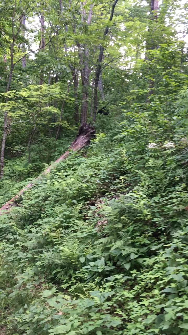
It is mid-morning, and we have about ten miles till we reach Mollies Ridge Shelter. We enter the woods once again after entering the park on blacktop. We have all heard and read stories about how black bears are much more prevalent in the national park and we aren’t in the woods for more than ten minutes when we have our first sighting. Sitting on his haunches about 25 yards off the trail, is this young black bear. Blake is the first to spot him and we stop dead in our tracks. Blake and I are hiking a little ahead of Chris and we wait for him to catch up as we stand there staring at the bear as he stares at us. Chris films the bear and takes a couple of photos but they do not come out very clear.
(Our first Black Bear Sighting after entering Great Smoky Mountains National Park)
The three of us hike our own pace much of the day: Blake in front of me by a few minutes and Chris trailing me. Chris and I develop some fun animal calls back and forth so I can make sure he is still within hearing distance and so I would know he is OK. (For the curious readers, my call is somewhat bird-like and Chris’ return call is monkey-like.)
This is the first time on the AT that I am somewhat hiking by myself since Julie is no longer with me and Blake and Chris are well in front and behind me. Not sure if it because we are in the National Park, but I begin to notice a lot more wildlife (well, actually hear more than I see). Small mammals, I assume, are scurrying here and there in the brush as I approach. And for the first time (although, not my last), I spot a flock of (or a least about six) wild turkeys. These are the largest birds I have ever seen outside captivity, standing at least 3-4 feet tall. They are only about 10 feet from the trail and are casually walking away into the woods. I have lost my photographer (Julie) and my phone/camera is stored away in my pack so the photo documentation of the rest of the hike is pretty much nonexistent.
Every mile or so, I would catch up with Blake and we would then wait together for Chris. Our hike continued that way until almost reaching Mollies Ridge Shelter. I catch up to Blake about a quarter of a mile before the shelter and using my call, I confirm Chris is not too far behind us. Blake and I are chatting when all of a sudden a large, black bear runs across the trail about 30 feet in front of us. We stop in our tracks looking all around. The brush on either side of the trail is thick and we can see no sign of where the bear went. We cautiously continue down the trail to where the bear crossed and see no evidence of him. This sighting is just another reminder that the bears are probably everywhere in these woods.
Chris catches up to us and we tell him about the bear, but he has had no sightings all day long other than the one we saw after entering the park. The three of us approach Mollies Ridge Shelter and it is swarming with hikers. Although we have the required Backcountry Permit to stay in the shelter, the shelter is overflowing. Tents are also pitched in numerous locations. The three of us find a spot a few yards behind the shelter and we begin pitching our tents. The site has bear cables, so after dinner, we are able to hoist our bags into the air, realizing the importance of this after spotting a bear so close to this shelter location.
Once we are all settled in, we join a group of younger hikers around the fire pit and exchange stories. There is also another strange group of hikers behind the shelter (near where the three of us pitched our tents) who claim to be some sort of theater group and are rehearsing what I assume to be a play. After the sun has set for a while, I decide to call it a night, really feeling the effects of the past four days and almost 40 miles of hiking.
Day 5: Mollies Ridge Shelter to Derrick Knob Shelter (12.0 trail miles)
Things get a little sketchy from here on out. Like I said, I have lost my photographer (Julie) and I have neglected to take notes for the remainder of this hike and relying on my memory is a dangerous thing. What I do know is that the three of us continued to hike our own hikes and eventually, throughout the day, we would meet up and swap notes and rest before continuing on in the same fashion.
I do remember two separate events clearly during this 12 mile hike that stand out:
- The Rain: It was the first rain of this hike, and it sure put a damper on things. I am already pushing 50 miles for the week and I am feeling it. I remember this is just one of those days that I just put my dead down and I walk in the rain as fast as I can, pushing myself to get to the shelter as quick as I can.
- The Turkey: I previously mentioned the small flock of wild turkeys I observed the previous day. Those birds were having their own stroll, paying no attention to me. Well, today is a different story. I’m pretty sure I’m going to have to fight a turkey today. I do not exactly remember what time of day or on what stretch of the trail I am on, only that Blake, Chris and me are separated by some unknown distances on the trail (I do remember no return monkey calls from Chris, so he is a good distance behind me). As I am strolling on a somewhat flat stretch of the trail, I notice a large, male turkey ahead and to my left, only a couple of yards off the trail. I as I get close (within about five yards), the turkey spreads his wings, somewhat flapping them, showing aggression towards me. My immediate reaction is to raise my walking stick (which is fairly substantial) and I shove it in the turkey’s direction. He does not like that! I assume he is protecting his territory, so I just continue to walk intending to just pass him by and leave him to his turf. He has other plans (or possibly his turf covers a few hundred yards). As I start to walk past his blustering self with my stick jabbed in his direction, he starts to trot along the trail in front me, still with outstretched wings and making loud turkey noises that I will not try to represent here in print: let’s just say they sounded nothing like “gobble, gobble”. I continue to walk as he runs in front me, occasionally turning to confront me. I would jab my stick towards him and he would turn and run. Twice he crossed the trail back and forth, zig zagging in front of me, all the while puffing his chest out, flapping his outstretched wings, making that awful squawking noise and feigning a charge towards me. This dance lasts about 5 minutes for several hundred yards down the trail before he either gives up or perhaps I exited his territory. It did take me several minutes to realize I could loosen my grip on my stick, which all the while I had at the ready to swing like a baseball bat.
I guess from a chronological stand point, the turkey incidents occurs first, because I do remember trudging along in the rain trying to get to Derrick Knob Shelter as fast as I can. It just stops raining when I reach the shelter about 1600 and I am soaking wet, but having hiked with my pack cover on, all my pack contents are nice and dry.
I quickly claim a spot in the shelter all the way against the right hand wall. I change into some dry clothes and climb into my sleeping bag to warm up. After about an hour so, Blake and then Chris arrive at the shelter and they pitch their tents in front of the shelter. We all have dinner together and recap the day, but then I am back in my sleeping bag seemingly not able to get warm. After today’s rain and with the sun going down, the temperature is little bit more on the chilly side than on previous evenings.
Day 6: Derrick Knob Shelter to Clingmans Dome (10.1 trail miles)
Day 6 is more of the same as Day 5. No pictures taken; no notes written down; just a memory of seemingly walking uphill the whole time with rain pouring down on me. The three of us are spread out on the trail, each of us doing our own thing. And this is to be our longest hike for the week: 13.5 miles to Mt. Collins Shelter!
The five mile approach up to Clingmans Dome is a beautiful hike (at least the part I remember as I peer out from the rain dripping from the brim of my LSU cap). The forest opens up to reveal vast numbers of firs and red spruce trees. The forest floor is layered with needles from the trees. I do regret not being able to enjoy the surroundings more, but the weather conditions just were not favorable. Late afternoon, the rain stops and fog begins to set in and the temperature drops a few degrees.
At some point on the climb up to Clingmans, I pass Blake and keep on trudging uphill. At about 1600, I arrive at the point where the trail is just about 20 yards from the approach ramp to the Clingmans Dome Observation Tower. There is a sign pointing to Mt. Collins Shelter, only a short 3.4 miles further north.
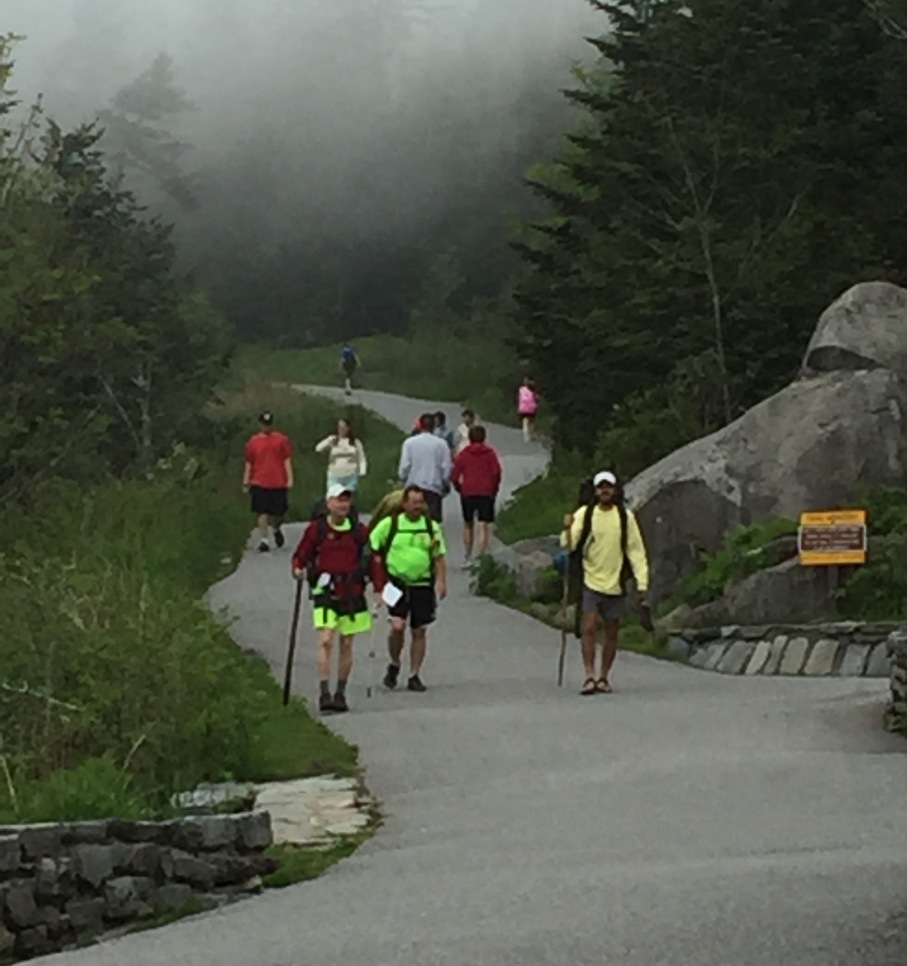
I can hear visitors passing on the asphalt pathway leading to the tower, but I am unable to see them through the trees. I make my way from the AT to the road leading to the tower and I find myself in the midst of civilization: at least the part of civilization containing clean people in normal attire walking to and from the observation tower. I’m getting looks like I’m an animal who just escaped from a zoo, so I ramble back to the AT. It isn’t long before Blake arrives and together we head to the road leading to the tower and walk the remaining couple of tenths of a mile to the spiraling ramp leading to the top of the tower. Clingmans Dome is the highest point on the AT, standing at 6,643 feet and Blake is anxious to take some good photos of the Appalachian Mountains from this view point. We make our way to the top of the tower, but the view is nonexistent. A heavy fog has settled down all around us and it even starts to rain again only after being at the top of the tower for five minutes. Somewhat disgusted, I head back down but Blake says he is going to stay awhile. I make my way back to the AT to wait for Chris.
After arriving back at the AT, I remove my pack and settle down to wait for Chris. Now that I am not moving, I realize how cold I am. I am still soaking wet from the rain and the heavy fog has everything around us damp: there is no drying out. I begin to shiver uncontrollably. Blake arrives and he sees me shaking and offers a clean, dry, long sleeve shirt from his pack. That helps a little. But the most brilliant idea was when I broke out my camp stove and lit it up. We both hunkered down around the stove keeping our hands and feet close. We would alternate holding our baseball caps over the flame and placing them on our heads to keep our heads warm. We knew we probably had another couple of hours sitting here until Chris arrived; and then there was the 3.4 miles further to get to Mt. Collins Shelter.
I honestly do not remember who came up with the idea; whether it was me or Blake. But it was definitely the best decision made that whole week! We formed a plan to call Julie (who, if you remember, left us at Fontana Dam and secured a hotel room in Cherokee, North Carolina and who was waiting to hear from us tomorrow for extraction at Newfound Gap). We debated briefly whether Chris would mind ending the hike early; very briefly. Once we made the executive decision to make the call and end our hike here at Clingmans, the rest fell into place. We walked back out to the roadway leading to the tower to get a signal. Using Blake’s phone, we called Julie. She said she certainly could pick us up at the parking area for the tower and that she could be there in about two hours. She also told us that she had a hotel room with two queen beds so the living quarters were covered too. She hung up and headed our way.
This will probably not surprise many of you reading this, but of course Blake and I conspired to not tell Chris when he finally arrives that we called Julie to pick us up. And as expected, Chris does arrive around 1800. Our plan is to tell Chris that we only have 3.4 miles to go before the day is done (“Might make it before dark if we hurry, Chris!”). We both just want to see the look of utter disgust on his face and then, after telling him of our phone call to Julie, the look of confusion slowing giving away to a dawning expression of understanding and then relief followed by excitement; then quickly followed by suspicion because he isn’t sure what we are telling him is truth or fiction. It is somewhat hilarious as he goes through all these emotions in about a two minute period, but then Blake and I are able to convince Chris that we did indeed call Julie for early extraction (“Hope you don’t mind we called, Chris?” followed by “Hell, No!”).
As we gather our gear and head down the road leading to the parking area for the observation tower, we get a call from Julie letting us know she has arrived. It is about three tenths of a mile down to the parking area, and we are all smiles as we see Julie and the Tahoe in the distance. We may have cut this hiking week short, but it was still a challenging week and we still covered a lot of distance. Julie completed 28.7 miles in 3 days; I completed 61.8 miles in 6 days; and Chris and Blake both completed 56.1 miles in 5 days. And now we have an opportunity to begin next year’s hike at Clingmans Dome and hopefully, if the weather cooperates, Blake can get the photos he wants with all of us in the picture!
Epilogue
After throwing all our gear into the back of the Tahoe, we begin our trip to the hotel in Cherokee. Julie has secured a room on the first floor with two queen beds. While we each take turns enjoying a hot shower and slowing returning to that state of normalcy, Julie is kind enough to gather some of our dirty clothes and wash them in the hotel’s laundry room. These freshly washed clothes along with the change of clothes we left in the Tahoe at the beginning of our hike provide us a change of clothes for the day and tomorrow’s trip to Memaw and Pop’s.
After we are all cleaned up and rested, we head out to find a place to eat dinner. We all decide to try a local place call Paul’s Diner. We order more food than the table can hold, including buffalo burgers with cheese, fried pickles, and French fries. Best meal of the week!
We do a little sight-seeing around Cherokee, but the weather is dreary with rain sprinkling on and off. So we head back to the hotel and we all settle into bed. It doesn’t take long for us all to doze off – I think it might have been 2100!
We wake up to a beautiful Friday morning. We have all day to make our way south to Lawrenceville to have dinner with Memaw and Pop. We have a simple, complimentary breakfast at the hotel and then we all pack up our things, check out of the hotel and hit the road.
Part of our AT experience is trying out the local craft breweries in the area of the trail we are hiking. This year we are near Gatlinburg, Tennessee and there is a local brewery and restaurant called Smoky Mountain Brewery. Before we head south, we head slightly northwest to eat lunch and try a few of their beers.
After our meal and the sharing of three rounds of flights, I decide to purchase a growler of Smoky Mountain Brewery’s Tuckaleechee Porter. After much debate, I finally decide to buy the more ornate growler with the pewter handle, versus the standard amber, glass bottle. The reason I decided to go with the more fancier growler is because this brewery location is a little too far removed from the trail, especially now that we are heading further north and east (away from Gatlinburg), so a refill will probably not be in my future. So now I will have a decorative growler to display as a keepsake of this year’s hike.
It is early afternoon when we leave Gatlinburg and we map out our trip to Lawrenceville, figuring in two more beer stops along the way.
I have brought my two empty growlers from previous trips (one from Nantahala Brewing and the other from Lazy Hiker Brewing) with the intention of bringing home craft beer from these craft breweries that we cannot purchase where we live. So our first stop is Nantahala Brewing in Bryson, North Carolina. We pop in for a quick beer and a refill of my growler (Bryson City Brown Ale) then it’s back on the road heading south.
Our second stop is at Lazy Hiker Brewery in Franklin, North Carolina. This has become one my favorite stops. Terrific atmosphere, friendly service and great beer! We linger here a little longer than we did at Nantahala since we are doing great on time. Our goal is arrive at Memaw and Pop’s in Lawrenceville early evening. After a couple more pours and a refill of my growler (Amber Ale), we pile in the Tahoe and make our way to our final stop of the day – Lawrenceville, Georgia. And I have to give a huge shout out to Julie here, since she is the one who is driving us around and allowing me, Chris, and Blake to enjoy the beer as she provides the safe transportation.
We arrive at Memaw and Pop’s early evening as planned. There are plenty of hugs to go around and we are ushered inside to the smell of a wonderful meal cooking. As usual, Memaw and Pop feeds us to extreme – until all we can do is waddle into the living room where we sit back, relax, and recap our adventures of the previous week. After a couple of hours of storytelling, eyes begin to get heavy and we all retire to our respective bedrooms.
After another good night sleep, we awaken to bright, sunny Saturday morning. We all load our things into the Tahoe and say our goodbyes. Unlike previous years, this one is a normal, uneventful drive home. No cut gas lines; no dead batteries; nothing out of the ordinary. Blake had us stop at a store with a Redbox so he could get a movie and he and his dad watched movies most of the way home – it was like driving home with two well behaved kids in the back.
We dropped Chris and Blake off in Slidell Saturday evening and made our way back to Houma – again, an uneventful drive across the lake back to our house, thus ending our 2016 AT hike.
Until our next hiking adventure!
P.S. This is Julie ~ I finally got to see a bear!


